Case Study – Redwood City Downtown Precise Plan
A Community Remaking Itself
Place-type: Urban Neighborhood, City Center
Overview
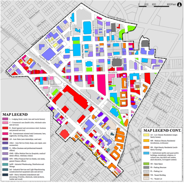
The Redwood City Downtown Precise Plan (DTPP) was created to revive the heart of Redwood City. It covers 183 acres within the city’s historic center including two historic residential neighborhoods. Most of the DTPP area lies within a quarter-mile radius of the Caltrain station—an ideal size for a walkable district, about a ten-minute walk end-to-end. The Plan acts as a detailed zoning and design code that regulates land use and development within the downtown area. It also guides private and public investment actions in support of downtown growth.
Policies/Ordinances that Contributed to Project Success
- The DTPP authorizes up to 2,500 additional market rate and 375 affordable housing units for households earning no more than 80 percent of the area median income. The City has adopted policies and programs such as impact fees and incentives to promote the development and preservation of affordable housing.
- The DTPP adopts a “Complete Streets” approach to street design to meet the need of all users, including bicyclists, public transportation riders, and pedestrians. The plan sets new standards for sidewalk widths, street trees, wayfinding signage and lighting scaled for people rather than cars, to increase pedestrian comfort and safety.
- The plan encourages the tallest buildings to be placed in the downtown core, and adjacent to the station area while limiting heights around key public open spaces and historic structures to maintain the character of these streets.
- The city’s progressive parking policy adjusts downtown parking rates by monitoring supply and demand to provide “just enough” parking and creates a “park-once and walk” district to minimize cruising.
- The Program Environmental Impact Report (Program EIR) assesses the project-level cumulative impacts of the proposed New General Plan. It is more exhaustive than an EIR for a single project and covers future developments.
Outcomes
Recent City-conducted residential housing surveys show an increase in walking, biking, and transit use and less driving alone for all trips. Higher densities, mixing land uses, and investments in multimodal facilities shorten trip length and encourage more non-auto travel options.
Redwood City now has four downtown parking garages with a total of over 2,500 spaces, plus the 160-space Caltrain lot and several smaller surface lots. City reports show that these facilities successfully accommodate current demand for parking. Most offer free parking on evenings and weekends. The City has also installed multi-space “smart meters” for on-street parking, with convenient payment methods, such as credit card or with a remote phone feature.
The DTPP has been supplemented with several new planning initiatives that will further enhance the downtown area and facilitate additional housing construction while managing traffic and parking impacts. RWCmoves, the city’s new transportation plan, provides a framework for a balanced multimodal transportation network addressing the City’s transportation challenges and needs. It offers transit and street corridor improvements, grade separation of the Caltrain tracks, a long-term vision for the downtown transit center and train station, new street connections, complete street corridors, and bike/pedestrian improvements.
Challenges and Lessons Learned
The DTPP took over 20 years to develop through a very thoughtful outreach effort. Despite these efforts, it faced a court battle that forced major revisions just before it was finally adopted in 2010. The Plan has since been amended twice. It has also been a challenge to create more open space for new residents in the fast-growing downtown area and encourage retail activity. Despite the addition of new businesses and residents in downtown, there has been a decrease in retail activity. The city hopes that the completion of all the developments will bring new retail and restaurants to the area.
The success of the Redwood City Downtown Precise Plan shows that urban areas can accommodate additional residential and retail spaces, while careful planning can minimize traffic and parking impact. The Plan’s design guidelines facilitate adequate parking without detracting from the pedestrian character of the street. Since some drivers may be tempted to avoid slower arterial traffic by detouring through adjacent neighborhoods, the City is working to discourage cut-through with traffic calming strategies. Additional parking can be provided as needed and parking demand can be regulated through pricing and new technology.
 Additional Resources
- Redwood City, California, Downtown Precise Plan (adopted January 24, 2011, last amended November 28, 2016).
- Draft Environmental Impact Report for The Redwood City Downtown Precise Plan, City of Redwood City (August 2010).
- RWCmoves Draft Plan (October 2017).
- Redwood City El Camino Real Corridor Plan (December 4, 2017).